The name applies both to the escarpment, from which you can see for miles around,
and to the general heath area which functions as an invaluable leisure resource.
Just as well it was a terrible day for taking long-distance photos…
…it meant it was a bit cooler for walking. The highest point we hit today was Nanny's Rock. So says the map – we never saw the rock, but this oak tree was standing right at the junction as we turned left onto the Staffordshire Way.
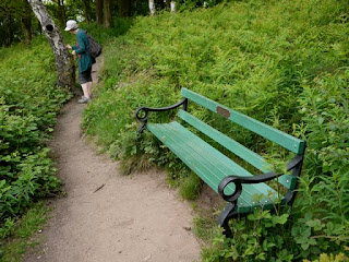
This part of the Edge is dotted with seats looking out across the drop. One commemorated a jazz player…
…while another honoured a soldier lost five years ago, and some had just a name or nickname.
We crossed the county boundary a couple of times, and came back via parts of the North Worcestershire Way. This moved us into farming and then equine country. A curious foal came to say hello.
Walking down the side of the Sladd Estate we passed this building.
The holes made it look like a dovecote from a distance. As we got nearer it seemed to be some sort of well-aerated barn, but I'm not sure it wasn't being used as a garage. Earlier in the day we'd encountered another garage which provoked some mirth.
The notice each side of the doors reads:
For me, 8 miles on the hoof today means I'm praying there are no emergencies tonight.


Awesome barn at The Sladd estate
ReplyDelete